
English| EUR
Suggested for you
More currencies
Choose a language
Navigating the waters of Banks Peninsula requires a solid understanding of local marine weather. This akaroa boating conditions guide breaks down the typical wind patterns, ocean swells, and sheltered zones you need to know before launching.
Quick answer
The optimal akaroa boating conditions typically occur between 09:00 and 15:00, when daylight is clear and sea states remain calmer. Because the harbour is open 24 hours a day with free public access, mariners must self-monitor the local forecast, paying close attention to sudden Canterbury wind shifts and incoming Pacific swells.
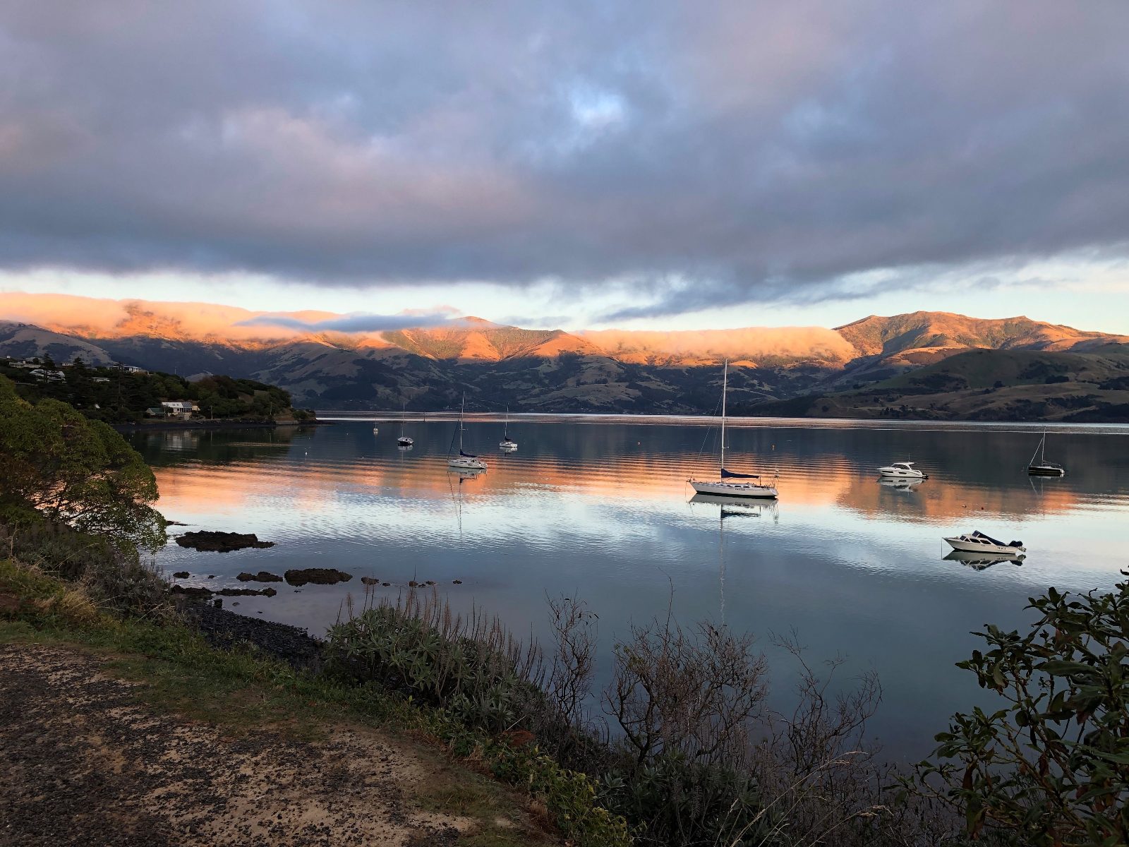
Akaroa Harbour is a flooded volcanic crater stretching over 16 kilometres from the Pacific Ocean to the township, creating a unique microclimate that heavily influences local marine forecasts. Because the inlet is flanked by the steep, rugged hills of Banks Peninsula, the waterway frequently experiences localized wind funneling that can alter the sea state within minutes. Understanding the daily akaroa boating conditions is crucial for anyone venturing out on the water, whether navigating a motorized vessel or a sea kayak. The harbour’s topography means that while French Bay might appear completely glassy in the early morning, the outer heads near the Pacific entrance could simultaneously be dealing with rolling coastal swells. Recognizing how the surrounding geology dictates surface behavior is the first step in planning a safe excursion on these historic, deep-water channels. The most significant factor driving the Banks Peninsula sea state is the prevailing Canterbury wind system. During the warmer months, northeasterly breezes tend to build throughout the late morning, gradually creating a surface chop that peaks in the mid-afternoon. However, mariners must remain particularly vigilant for the sudden arrival of southerly busters. These aggressive cold fronts push up the South Island coast, driving steep, short-period waves directly into the southern-facing mouth of the harbour. When evaluating an Akaroa Harbour weather report, checking the wind direction is just as vital as noting the wind speed. An offshore northerly wind will keep the inner basin relatively sheltered, while a strong southerly will push turbulent water deep into the inlet, drastically changing the akaroa boating conditions and requiring immediate retreat to protected coastal coves. Beyond the atmospheric pressure systems, tidal movements play a substantial role in shaping the daily marine environment across the entire peninsula. The ebb and flow of the tide moving through the narrow harbour entrance creates strong, localized currents that can interact violently with opposing coastal winds. When a fierce southerly wind meets an outgoing tide, the resulting pressure builds hazardous standing waves near the outer heads, creating treacherous zones for smaller craft. For those planning a trip, monitoring the official Canterbury regional council updates provides the most accurate baseline for safety before committing to an excursion. Knowing how to interpret these combined tidal and atmospheric forces ensures that visitors can make informed, practical decisions before ever leaving the boat ramp. While the inner bays often maintain a deceivingly calm profile, respecting the broader coastal geography and its volatile weather shifts is the defining rule for navigating this maritime region successfully.
“While French Bay might appear completely glassy in the early morning, the outer heads near the Pacific entrance could simultaneously be dealing with rolling coastal swells.”
The best arrival window for boating in Akaroa Harbour is 09:00–15:00, which provides optimal daylight conditions and typically calmer sea states. Planning your time around this window is essential to avoid the afternoon winds that frequently develop in the harbour.
Warm, 18°C–23°C; consistent sea breezes
Longer daylight hours allow for flexible outings within the optimal window.
Mild, 12°C–18°C; stable conditions
Clearer days often provide the most consistent calm water for kayaking.
Cool, 7°C–12°C; potential for southerly swells
Requires careful monitoring of weather patterns and colder water temperatures.
—
Provides the highest probability of calm water and minimal wind interference.
Verdict: Plan your visit between 09:00–15:00 on a weekday during March or April to benefit from stable sea conditions and lower visitor numbers.
Akaroa Harbour is accessible to the public 24 hours a day, seven days a week. While the water remains open at all times, safe boating conditions depend on daylight hours and current weather patterns.
Preparing for a safe transit of Akaroa Harbour requires specific maritime equipment and documentation.
Everything you need to know about akaroa boating conditions
Akaroa boating conditions are generally temperate, though they can change rapidly due to the volcanic nature of the harbour basin. It is important for all mariners to monitor tide movements and swell height before heading out.
The best time to assess akaroa boating conditions for a calm experience is during the summer months when wind speeds are historically lower. Checking local maritime forecasts ensures you avoid strong gusts that frequent this Canterbury landmark.
There is 0 NZD in terms of an entrance fee to access the public waters of Akaroa Harbour. This allows for free access to the bay, provided you adhere to regional navigation bylaws.
Checking current akaroa boating conditions is essential for kayaking, as strong southerly winds can create choppy surface waters. Paddlers should always remain aware of their proximity to the shoreline and changing weather patterns.
The best arrival window is 09:00–15:00, which offers optimal daylight conditions and typically calmer sea states for boating. Planning your excursion during this period helps maximize visibility and comfort on the water.
The inner harbour often provides sheltered inlets that are suitable for beginners, provided that akaroa boating conditions remain stable. Always assess the wind direction and vessel traffic before launching your craft.
You can find official information and regulatory updates on the official site at https://www.ecan.govt.nz. This resource provides necessary data on harbour hazards, channel navigation, and environmental protection guidelines.